By Dideka Njemla
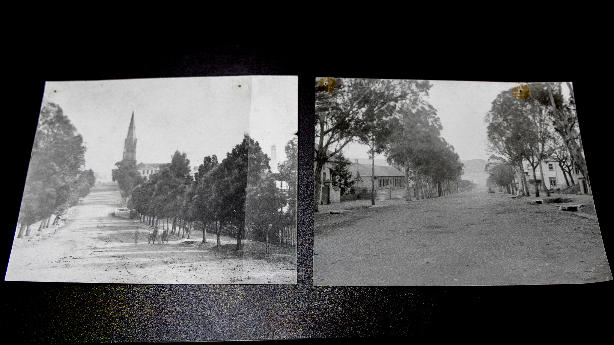
Makhanda’s trees — indigenous and alien — give a unique character to the central business district’s biodiversity and streetscape. Verge of Change, which has taken on the urban renewal of the CBD, in collaboration with Rhodes University’s Geography Department, is now turning its attention to the trees. Phillippa Irvine brings her expertise to this tree-mapping project as a geography lecturer from the university and an active member of the Verge of Change. “The Verge of Change is something that I’ve been doing in a semiprofessional capacity, and it brings together my interest in civil society, community and heritage,” she said.
Reviving the city centre
Irvine explained how the focus on trees began: “A colleague from Rhodes University Community Engagement thought it would be a great idea to plant some trees in town and regreen it. I spoke to Dr Sinenhlanhla Memela about this idea because we both teach the 301 Geographies of Sustainable Development course which requires students to gain practical experience.”
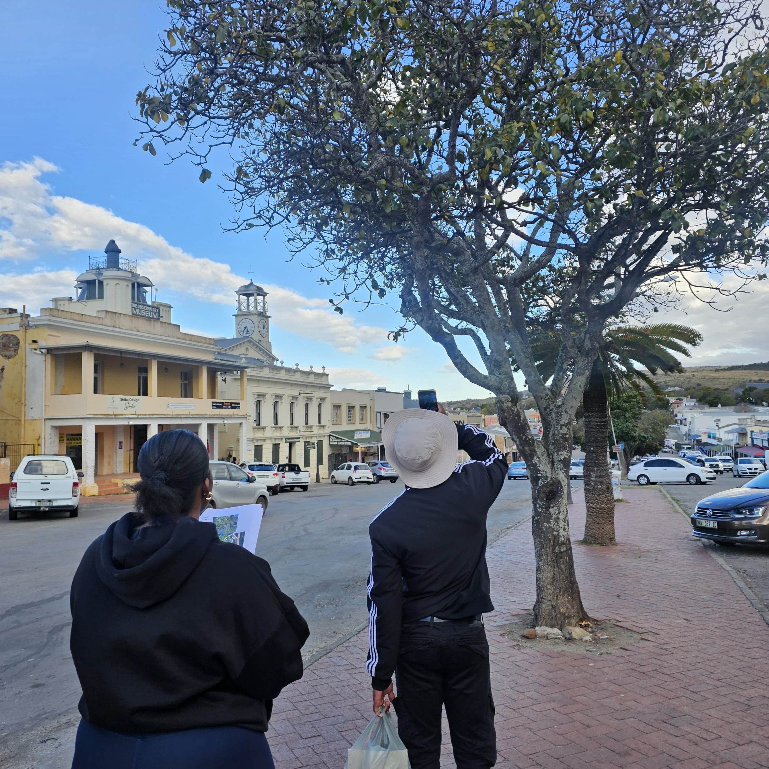
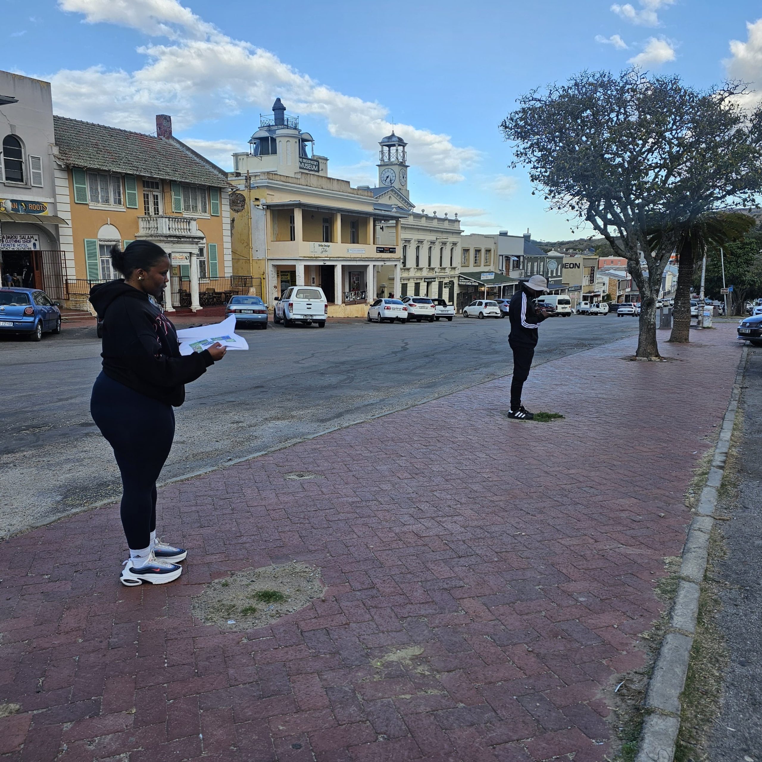
Memela then included this practical into the curriculum, highlighting it as a valuable opportunity for her students to apply their skills. “We adopted this idea and sent out groups of students to collect data about the existing trees.”
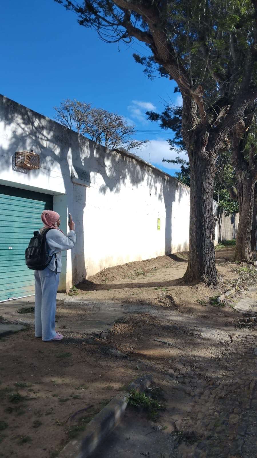
This data includes all sorts of aspects concerning the state of the trees, where trees are now missing and where trees can be planted. In addition the exercise of walking the city “is a great initiative to get the students thinking geographically as part of this exercise is about mapping. It’s crucial to spot gaps on the maps when examining the central area,” Irvine said.
When it comes to replacing trees there are numerous factors to consider: “Is it going to have its leaves all year round? What is the root system like? Will it destroy pavements, or will it interfere with and disrupt the plumbing systems? So, you’ve got to think about the species of the tree, and what it will require.”
The use of GIS
“Part of our software is the Survey 123 package that offers many different features. You can set it up on a phone to capture the geographic location and answer survey questions for that point. I can go up to a tree and determine its species and condition,” explained Irvine.
Memela said the software provides spatial information that can also be useful in helping to respond to the needs of community members. “If you walk in the streets, at times you may see the grass verge where we can plant trees or even areas where trees were picked, and those need to be attended to. This project allows our students to use their skills to respond to a local challenge.”
Indigenous and invasive trees
Makhanda has a rich variety of species as well as alien trees, such as the Jacaranda tree, which produces aesthetically pleasing, vibrant lavender flowers that bloom in springtime. “With the Oak trees and the Jacarandas, they form part of the historic and heritage aspect of town, and there’s no danger in them spreading. They will gradually be replaced as they die, but there’s no point in chopping down a 300-year-old tree. So, it’s important to balance the meaning that the tree has with other needs. So, we are not going around chopping down trees,” Memela said.
Identifying trees in need
With the help of a tree specialist, Irvine and Memela learned a lot more about trees on this journey. “We were told that when a tree needs to be replaced, there are certain things that need to be considered,” said Memela. “Sometimes they will get an infestation, or the tree dies. At times, property owners decide that they no longer want the tree.
“Students went out and identified the species of the tree because that’s important in understanding what we need to work with. It’s important to check the aesthetics of a place as well.”
An interesting observation is that from the exercise is that trees around town need pruning rather than being replaced. “They just need to be pruned correctly so that they don’t grow back into power lines. But it does seem that many of them have proper root systems, so they are not damaging buildings or pipelines,” said Irvine.
Trees are assets
The tree project has been using the expertise of a member of the National Champion Tree Panel, Mark Hazell, who has been working in horticulture for more than 50 years. Hazell, who is mentoring students, said: “Some of the students were quite intrigued by the fact that it’s not just a tree; you’ve got these trees that are assets, so they need to be treated as an asset.” He continued to emphasise the important link between the planting of trees and conservation, “There’s an interesting slide show from India that shows that trees over a 50-year life span are assets because they contribute about $190 000 worth of engineering services to the city. From pollution control, heat control, wind control and stabilisation of banks and streams.” Hazell noted that Makhanda has changed over the past few years. “We can see how planting trees has changed the landscape around the campus and around certain buildings that were very bland. We’ve seen how the whole environment changes and how the aesthetic changes. You get more diversity, and you create safe spaces for insects, plants and animals.”