


Vulnerable communities are likely to be severely affected by extremely cold temperatures in Makhanda and other parts of the Eastern Cape. Communities along the coast between Plettenberg Bay and the Fish River are also at risk from flooding over the next three days, Garth Sampson of the South African Weather service’s Port Elizabeth office says. In Makhanda, the next three days will be very cold.
A week of very cold temperatures is expected across most of South Africa from Tuesday, 20 July 2021, lasting well into the coming weekend. The cold temperatures will be due to a succession of cold fronts that are expected to sweep across the southern half of the country.
Disruptive snow falls are expected over mountain passes in the Eastern Cape and strong coastal winds will result in risky conditions in small harbours and ports between Plettenberg Bay and East London on Wednesday 21 July, the South African Weather Service (SAWS) says.
In Makhanda, the temperature is predicted to drop to a very cold 6C maximum on Thursday and only a little warmer (9C max) on Friday. Rain showers, starting tonight (Tuesday) are expected to continue through to Thursday when the most rain is predicted (10mm).
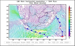
On Wednesday 21 July, heavy snow is likely to disrupt traffic on the Lootsberg, Wapadsberg, Penhoek, Outeniqua, Nico Malan and Winterberg passes, SAWS has warned. And with westerly to south-westerly, 55-65 km/h winds, waves 6 to 8m high will result in difficulty in navigation at sea between Plettenberg Bay and Port Alfred from Wednesday into Thursday morning (21-22/07/2021), reaching East London in the evening.
For Thursday 22 July, SAWS has issued a Yellow Level 4 snow warning for the same passes, as well as gravel road passes in the Tsitsikamma, Outeniqua and Baviaanskloof mountains.
“Yellow level 4 warning for rain leading to flooding of roads and settlements (formal/informal) is expected along the coast and adjacent interior between Plettenberg Bay and Fish River,” SAWS said.
Weather warning risk levels are on a scale of 1 to 10 and :”risk” is calculated as a combined factor of probability and severity. Level 1 is the least risk, Level 10 the most. Explaining what “Yellow” means, SAWS says Yellow is the least dangerous out of the weather warnings: “It means ‘be aware’. Severe weather is possible over the next few days and could affect you. This potentially means cancelling plans, having to deal with travel delays, road and rail closures, interruption to power and the potential risk to life and property.”
“Temperatures are about to plummet,” says Sampson. “Poorer communities are going to be worst affected, especially people living in shacks.
“Anyone outdoors in this weather is at risk of succumbing to the cold if they are not properly prepared and protected.”

Eskom has asked the public to reduce the usage of electricity as the adverse weather conditions kick in.
“The South African Weather Service has warned that a succession of cold fronts is expected to sweep across the country this week, going into the weekend,” Eskom said. “Following this warning, Eskom would like to appeal to the members of the public to reduce the usage of electricity as the cold conditions will put severe pressure on the power system.”
Eskom said the system was currently performing relatively well, and Eskom was not expecting to implement loadshedding at this point. The last loadshedding was on 13 June 2021 “due to some improvement in the performance of the Generation fleet”.
“However, the cold front will increase the demand for electricity thereby putting pressure on the power system. Therefore, Eskom urges the people of South Africa to help reduce electricity usage in order to ease the pressure on the system.”
A cold front made landfall over the south-western parts of the country on Monday afternoon.
Showers are expected to reach the western parts of the Eastern Cape, spreading to the Sneeuberg and Winterberg. Light snowfall is expected in high-lying areas and mountain ranges of the western parts of the Eastern Cape, including the Tsitsikamma, Kouga, Sneeuberg and Winterberg mountains.
A second, more intense cold front supported by an upper-air trough will affect the Cape provinces on Wednesday through to Thursday, consolidating very cold, wet and windy conditions over the majority of the Western and Eastern Cape interior regions, SAWS said.
“Following recent significant rainfall over the south-western part of Western Cape, the ground is still very close to saturation. Consequently, any additional rainfall over this region is likely to lead to incidents of localised flooding. This weather-related hazard is expected to particularly impact upon residents of informal settlements in parts of the Western Cape.”

