


By ROGER ROWSWELL
What lovely rainfall for the month!
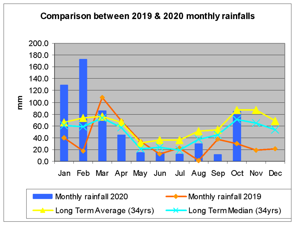
The rainfall for the months May to September was a total of 81.8mm. By 10 October we were at 71.4mm and on 29 October we just surpassed the five-month total for May to September 2020. At the end of October, at 599.0mm and with two months to go, we were just short of an annual rainfall of 600mm. This is significantly better than in 2019 (411.3mm).
When I started this series, I made the prediction that we would have slightly above the long-term average (LTA) rainfall in 2020. Now I’ll have to revise that to below the LTA (35 years) at less than 723.2mm.

Looking at past records, the lowest six events for combined rainfall for November and December ranged from 39.8mm (2019) to 77.0mm (1999) [46.7mm (1990), 61.9mm (2018), 70.0mm (1997), 72.6mm (1987) and 77.0mm (1999)].
The long term averages and medians for Nov and Dec are: LTAs 86.4mm and 68.9mm and LT Med 64.3mm and 53.6mm respectively. In other words, it is very difficult to anticipate what the next two months’ rainfall is likely to be.
Many of the above incidences were preceded by a similar rainfall to the 2020 Oct rainfall. However, currently the The Oceanic Niño Index (ONI) is on the decrease, -0.6 for (July, Aug, Sept), whereas in the above mentioned events all the ONI values were either increasing or on the level with the exception of the JAS value for 1999 which was at -1.0 and on the increase.
ONI is the most commonly used index to define El Niño and La Niña events.

